My site at the Blow Me Down Provincial Park has a strange layout: it is quite large, and has a decent slope from the road. Moving the bike around, I almost dropped it, twice! It’s a heavy bugger! Every 500km or so, I need to lubricate the chain. So far, the Bonnie runs like a charm.
After packing up, I look up a place to breakfast back in Corner Brook, then I ride out. Road 450 is pretty, hilly and curvy, a joy to ride on. I stop at the same spot as last evening to enjoy the view during the daytime.

After breakfast, I’m back on the Trans-Canada Highway. It’s one smooth road, sometimes divided, sometimes not. It’s certainly well-maintained. I make a pit stop in Deer Lake, then veer North on the 430, also known as the Viking Trail.

Not long after that, I come up to my exploration destination for the day: Gros Morne National Park. I love mountains, so I look forward to the views.

Park ranger Tara at the entrance highly recommends visiting the Tablelands. It’s a detour on 431, but well worth it, she says, so I turn that way. I was not expecting what I saw as I turned a corner: an unusual, orange, flat-topped mountain, barren of vegetation, poking above the surrounding, very green hills & mountain ranges. It looks totally out of this world, alien.

I learn that these were pushed up from Earth’s mantle 450 million years ago, when the Appalachian mountains were first formed. The rock is called peridotite, and it’s made of iron, magnesium, nickel, cobalt, and chromium, poisonous to many plants. When the rock is exposed to air, its surface oxidizes to create rust, which gives its orange colour.

I take a short trail to have a look at the vegetation. I take a few pictures of some of the flowers, including a weird shiny red one that’s turned downward, with two parts to the plant, a pitcherplant I think. Not sure about their names; I used Pl@ntNet to identify them. (I have more pictures, Mom.)


On the way back, I make a pit stop in Wiltondale, before moving back on the 430 toward my next adventure: Gros Morne. I didn’t plan on hiking, so I’ll have to come back with the right shoes to do the 8.5-hour difficult trek up the mountain, with good preparation and some friends.

Apparently, Gros Morne is just a big pile of sand that turned into rock over millennia.


All along the 400 series roads, we often see that most wondrous of signs, favourite of motorcyclists and sports car drivers: sinuous road ahead. Every time I see one, I have the same reaction, with a big grin on my face: Oh goody-goody-goody! Ok, be careful, and enjoy.

Route 430 between Deer Lake and Rocky Harbour has plenty of them; it’s certainly one of my favourites so far. I love leaning into the curves, rolling out of them, getting ready for what comes next. It’s exhilarating!
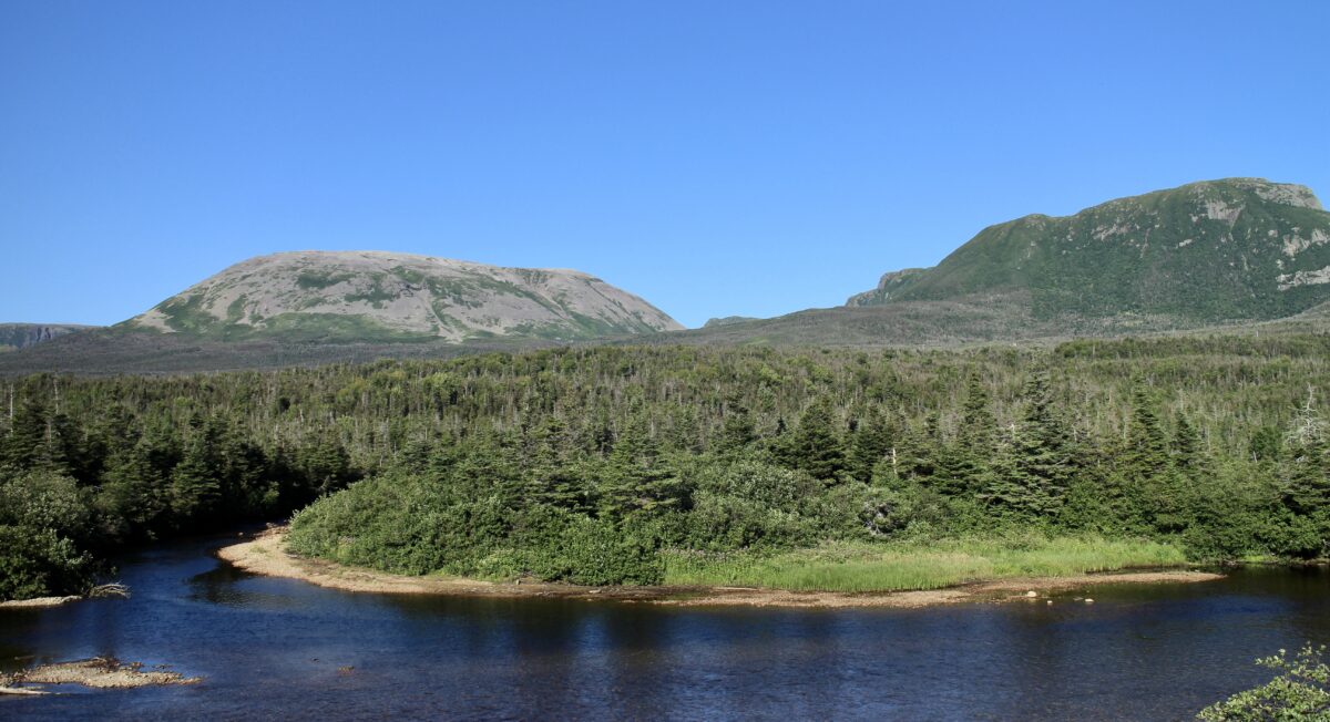
The road past Rocky Harbour is pretty flat and follows the coast of the Gulf of St Lawrence; it’s quite a change from the previous section. The landscape is quite flat here, but we can observe the mountains in the distance on the right.
I get to Shallow Bay Campground at the Northern edge of the park. I’m ready for bed. I have a long ride tomorrow…

Riding distance: 297km
Leave a Reply