Man, there are a lot of black flies at this campsite! I have to dress up to protect against them. My site is next to a beach, so the sound of the waves is relaxing as I fall asleep.
I can see the sun rising from my camp. Oh good, I can use it to dry up my tent, as I pack up in the morning. I look forward to riding in sunny conditions after the past two days of rain. it doesn’t take long for the tent to dry in the sun, so I’m back on the road pretty soon after.
It’s still foggy in parts as I ride down toward the ferry, but it soon dissipates the farther I go. As I suspected, the landscapes are beautiful; I take the opportunity to take a few pictures on the way.


As I arrive in Blanc-Sablon, I see the ferry arriving in the harbour, about to dock; I’m just in time. I buy my ticket, and wait to board, chatting with other motorcyclists in line.

The sea was much calmer than yesterday’s. I have breakfast and watch a show on my iPad. It doesn’t seem long before we reach St. Barbe. As I watch the ship enter the dock and start unloading trucks, I think of Steve who lives nearby and his stories; it warms my heart.

As I have some time, I decide to turn into Port au Choix to check out the National Historic Site. It’s located on a rocky Peninsula, not too far from the 430.
I meet David at the Interpretation Centre, who speaks French—he’s from Blanc Sablon— and tells me the stories and significance of this place: two Inuit people, a First Nations tribe as well as Europeans lived here over the past 5,000 years. They found archeological evidence and artifacts of their passage.


Only 2 kilometres away, to the point of the peninsula is a lighthouse, where I watch a small heard of caribou, chilling and munching on the local flora.


In the village, I stop at the Anchor Café: A cosy restaurant with style. As I walk in, I immediately smell the wonderful aroma of prepared seafood. Yum! I try their seafood chowder: it’s delicious! It’s certainly some of the best I’ve had so far. I also had a dish of cod and halibut: just as scrumptious.


I kiddingly give my waitress a hard time because she told me she doesn’t like seafood, and couldn’t recommend something based on experience. Ben là! She works at a seafood restaurant! She was great nonetheless.
I’m back on the road, well-satiated from the meal and my experience here. I’m glad I took the detour. I set out on the long trip South, on the coastline Viking Trail to Gros Morne Park. This time, however, I seem to enjoy the view even more. The coastline road seems less boring this time around.


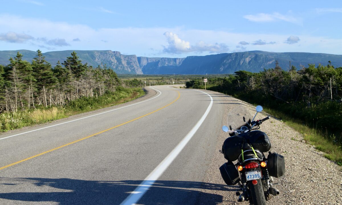
In the distance, on the left, I see a flat mountain range, broken up once in a while, like it was cut. These are the Fjords. I’d love to see them up close one day.


As I turn a corner, I was awed by one particular striking cut in the landscape. the picture doesn’t do it justice: I was flabbergasted! I had trouble maintaining focus on the road: I couldn’t keep my eyes off it!

I finally arrive in Gros Morne National Park. The longest part of the 430 is behind me, and I look forward to riding in the mountains.
The most beautiful route on my trip is the road from Rocky Harbour to the entrance of the park, in Wiltondale, specially with the late afternoon sun at my back: it’s so awe-inspiring, I let it all in; I have goosebumps the whole way down. The road surface is pristine, the views… Oh, what views! I have no words. On the bike, it’s absolutely exhilarating to ride; I get so absorbed in the experience, I forget to take pictures. I would do them no justice anyway, you’ll just have to experience it for yourself.
I make a pit stop in Corner Brook, then go a little farther South to the Barachois Pond Provincial Park to camp for the night. I reflect on the wonderful, dynamic, peaceful, or captivating rides of the day. Man! I love this place!


Riding distance: 518km
Leave a Reply